
./HoleToAnotherUniverse=>

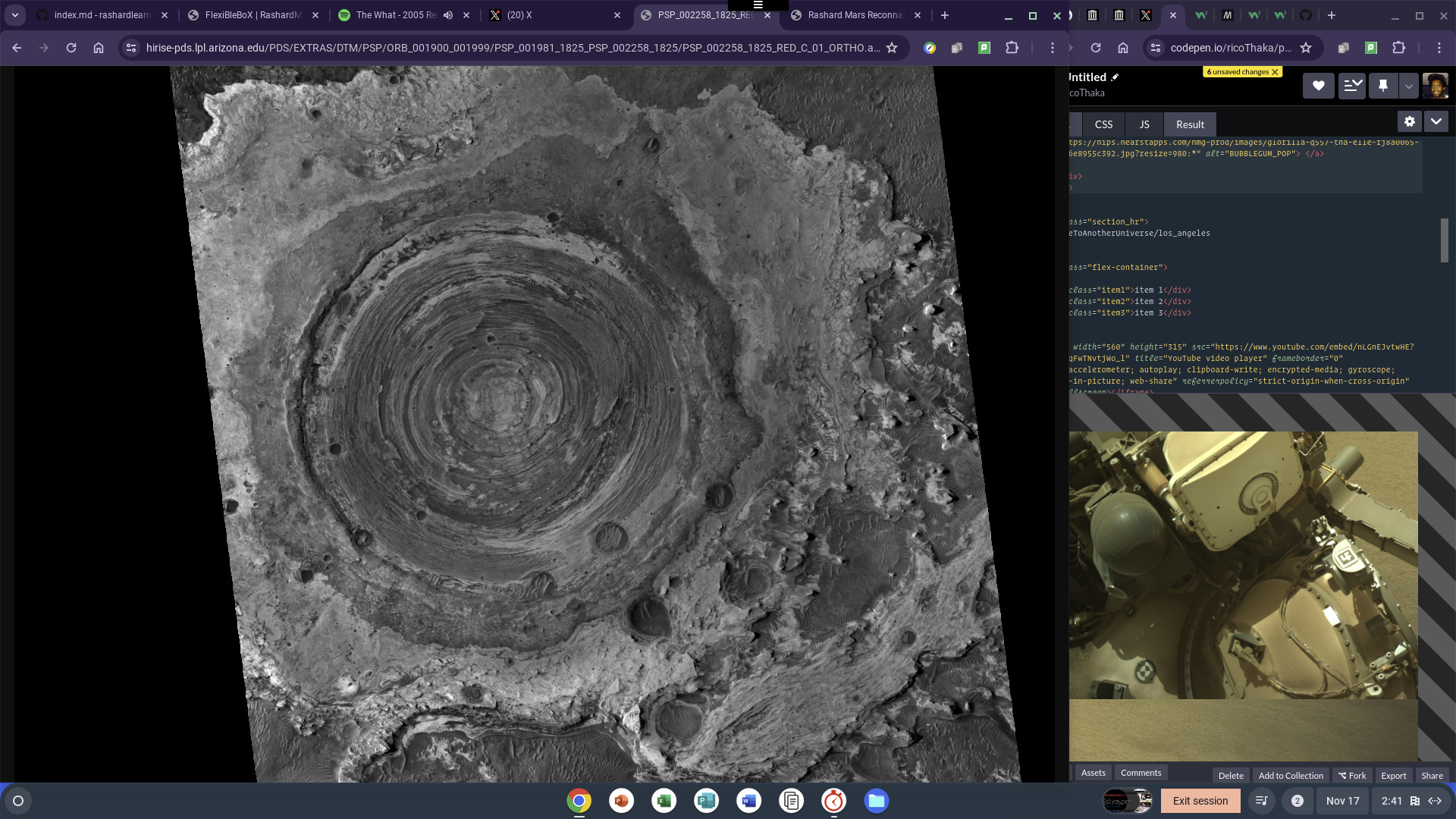
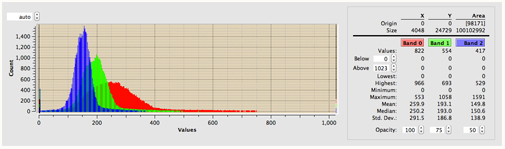
HiView Image Viewer - Software
WHAT HiView DOES
HiView is a data explorer and image viewing application supporting the JPEG2000 image format 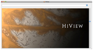 HiView is the best way to explore HiRISE images of the Martian surface at the full resolution of the imagery. Tracks of boulders that have fallen down crater walls, delicate rays of ejecta from fresh impact craters, and the unearthly formations created by carbon dioxide ice on the Martian south pole are just a few of the things that are waiting to be discovered by anyone using a tool like HiView with HiRISE imagery. Video Tutorial
A Latinx Resource Guide: Civil Rights Cases and Events in the United States
1968: East Los Angeles Walkouts
Discrepancies in the education of Anglo and Mexican-American students surfaced in Los Angeles during the 1950s and 1960s. Mexican-American students experienced a 60% dropout rate from high school, and those who did graduate averaged the reading level of an 8th grade Anglo student. In some schools, teachers prohibited students from speaking Spanish, and in others, school staff recommended Mexican-American students educational curriculum meant to help students with mental disabilities. These schools funneled many Mexican American students into vocational programs and discouraged from post-secondary studies. In response, students, teachers, parents, and activists began to organize.ContinueReading Related Tweet EastLosangeles Today
1986 SPECIAL REPORT:”THE VANISHING BLACK FAMILY”
LAPD DETAinMENT on METROLA CoronaVirusPAtent European Publication Server
![]()
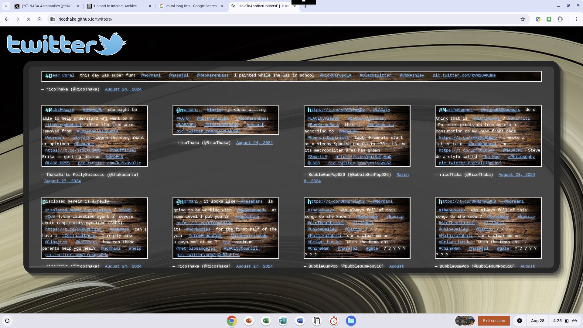
Dear Rep/Mayor Karen,
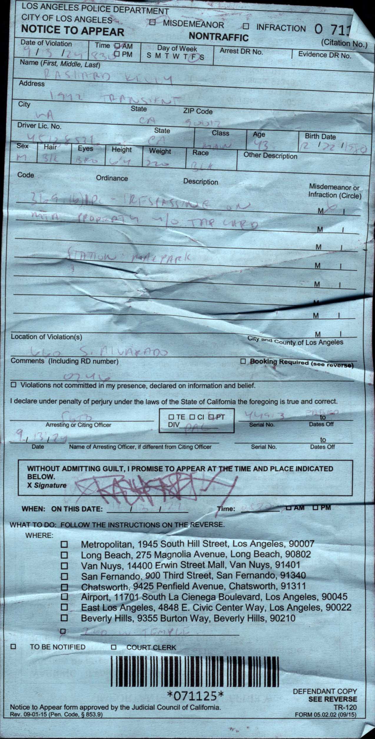
I signed up for a class that NASAJPL is offering at CourtYard by Marriot Pasadena. As you can see in the LAPD DETAinMENT on METROLA PDF, I was accused of Tresspassing. I i dont know what i need to do to use the transit system safely. LAPD is pushing FareEnforcement but are not making exceptions. If you look at the graphic below in my GMAiL_EMAiL_iNBOX you will see that Los Angeles Police never emailed me back after i was victim of that Armed Gunman at CityHAll with the Playboy Backpack on, so this Tap card thing. I see people at Saint Francis with MailBoxes and There is this place in Santa Monica that offer mailboxes, but im in a different situation since i was Abandoned. I took a shower at Reality_LA, AND I KNOW The Medicated Shampoo and Terry Cloth towel Pulled out at least 200 bugs! The Larve breask my hair down and it just cracks off while Dry Scapl tortures me with itching and burning. Please send a team from NasaJPL to talk to them about what Entomological warfare looks like in Los Angeles .
So I want to make sure i can make the ECOSTRESS Science and Application Team Meeting - Fall 2024 meeting and start making more progress on getting my badge back. Whereever my daughter is, Erika, and the dancing girls… Id dont matter! I have to be badged. A California driver’s license used to be easy to renew. People will not call nasajpl and they look criminal all through los angeles. One of those briefcase Cellphone providers i tried made me scared bc the calls to the front desk are routed to a Hollywood Action Movie actor who was lying to me about important processes there. HollywoodFoodCo have raffles fo id_vouchers. They have no idea how silly they look every single time i get that mediocre ass food! dead bird etc no rice… Click here to see NASAJPL coverage of the LosangelesHeat wave and its a conversation that connects to P{Hytoplankton}, Chemical Lacerations, and unwanted amputations implemented on “The Homeless”
Related Tweets
- #its_Rashard iSigned up for the #ECOSTRESS_WORKSHOP #NASAJPL PasadenaFD
- #Akire Uhave #FaceToFaceHistory with @B2K @marqueshouston!he works for 911LAPD today I wrote @normani a mushy note an #the_nigga_forced_me_to submit a #FingerPrint! and called me #Transient! there was twitter rhythm in the detainiment @uspto those #Perl sites are blocked @LAPublicLibrary http://appft.uspto.gov and http://pdfaiw.uspto.gov @esa @nickyjenner1 @nasamars #Help #XML Ms Karen Bass I got the Covid Patents from pdfaiw.uspto.gov My History NASAJPL+JEHOVAHSWiTNESSES VanishingFamily NASAJPL on HOLLYWOOD WALK OF FAME Rumatoid Authritis ,,, is it Chemwar? LA COUNTY MAPPiNG DATA
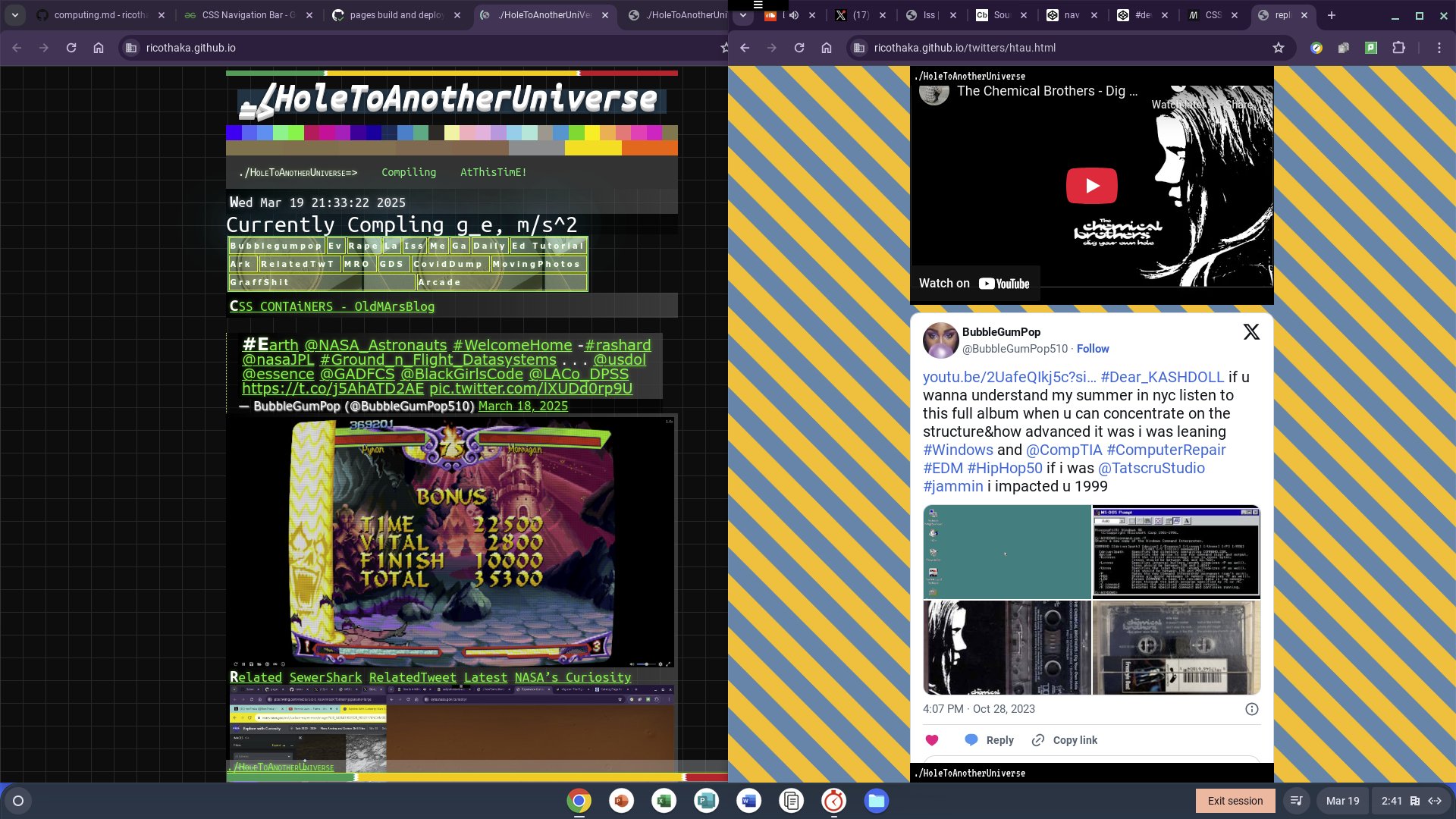
https://t.co/epfIATepb7 @RepKarenBass @LACityCouncil @SFCLA @HollywoodFoodCo @WeingartCenter @NASAJPL I signed up for the #ECOSTRESS workshop #Pasadena @metrolosangeles @LAPDOutreach https://t.co/8TPHSNFFfb #FareEnforcement @normani pic.twitter.com/APQX4kRqW1
— ThakaRasharD (@MooNLOVER404) September 14, 2024
![]()

 Vergara, Camilo J., photographer


Los Angeles
Urban Heat Image
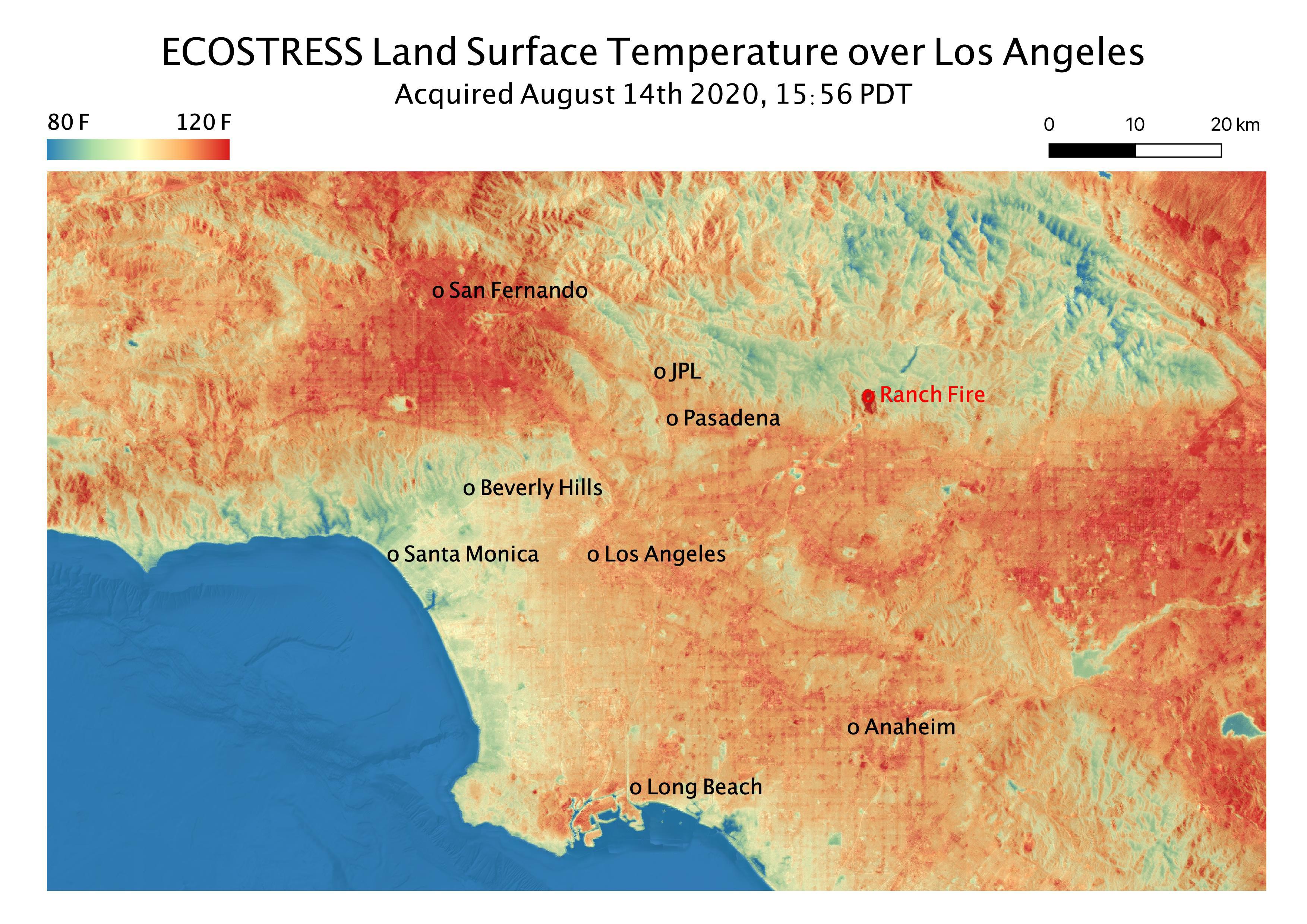
Greater Los Angeles is a prime example of an urban heat island - cities and suburbs woven with heat-trapping concrete and asphalt that lead to warmertemperatures than nearby rural areas that have more vegetation. Bordered by mountains and the ocean, the Greater L.A. area encompasses suburbs andskyscrapers, with a dense population and disparities in green space. It includes several counties, tens of thousands of square miles, and more than18 million people, making it a compelling test bed for heat wave research.
Climate change and urban heat are together fueling different heat waves now. In the 20th century, most heat waves in L.A. were dry. However, humidevents have steadily increased in frequency and intensity since 1950 due in part to swelling moisture from the warming sea surface.
In their case study, JPL scientists compared two heat waves that affected the Greater Los Angeles area in the summer of 2020: a prolonged muggystretch in August and an extremely dry three-day spike in September. During the latter event, record-breaking temperatures soared over 120 degreesFahrenheit (49 degrees Celsius) in the San Fernando Valley - a densely populated portion of the city of Los Angeles - while scorching winds fanned adestructive wildfire in the nearby San Gabriel Mountains. For their study, recently published in the Journal of Applied Meteorology and Climatology,the scientists used NASA’s Modern-Era Retrospective Analysis for Research and Applications, version 2 (MERRA-2) data set - a reanalysis of historicalatmospheric observations. They found that both heat waves drove temperatures above the 90th percentile for the August-September climate record in L.A.Using advanced weather modeling, they simulated the heat waves and looked at their impacts across the region Continue Reading
More than half of California is now ‘abnormally dry,’ drought experts say Newsom lifts drought declaration for most Californians, yet measures remain in some area Gov. Gavin Newsom drops drought emergency for Southern California and Bay Area
![]()
 The Advanced Spaceborne Thermal Emission and Reflection Radiometer (ASTER) is an imaging instrument onboard Terra, the flagship satellite of NASA’s Earth Observing System (EOS) launched in December 1999. Try The MAps!
Halfway through the water year, California-Nevada precipitation is near-normal, with above-normal snowpack. State Water Project Advances Efforts to Prepare for Future Droughts Amid a Changing Climate Drought conditions have mostly disappeared in California. It’s a first in more than a decade
Jose Crazy!
he think he can control your hiring, how do i fix it Jose Nasa


NasaJPL:: M_R_O Normani is a Physical Fitness professional in the area, i still think she took my child in makeup. This is the thing. There was some sort of commitment and upon exit it was this face off with Manessa and I end up OUt here. Erika’s new mate was invasive and had a strange interest in Our daughter, so if she removed her the wrong way, i think it was for Corals Protection. look at these FacebookVideos of Corals Removal Manessa On Instagram Doing a Forced Removal Dekalb County Sherrif moves forward to take the child And im not crazy!
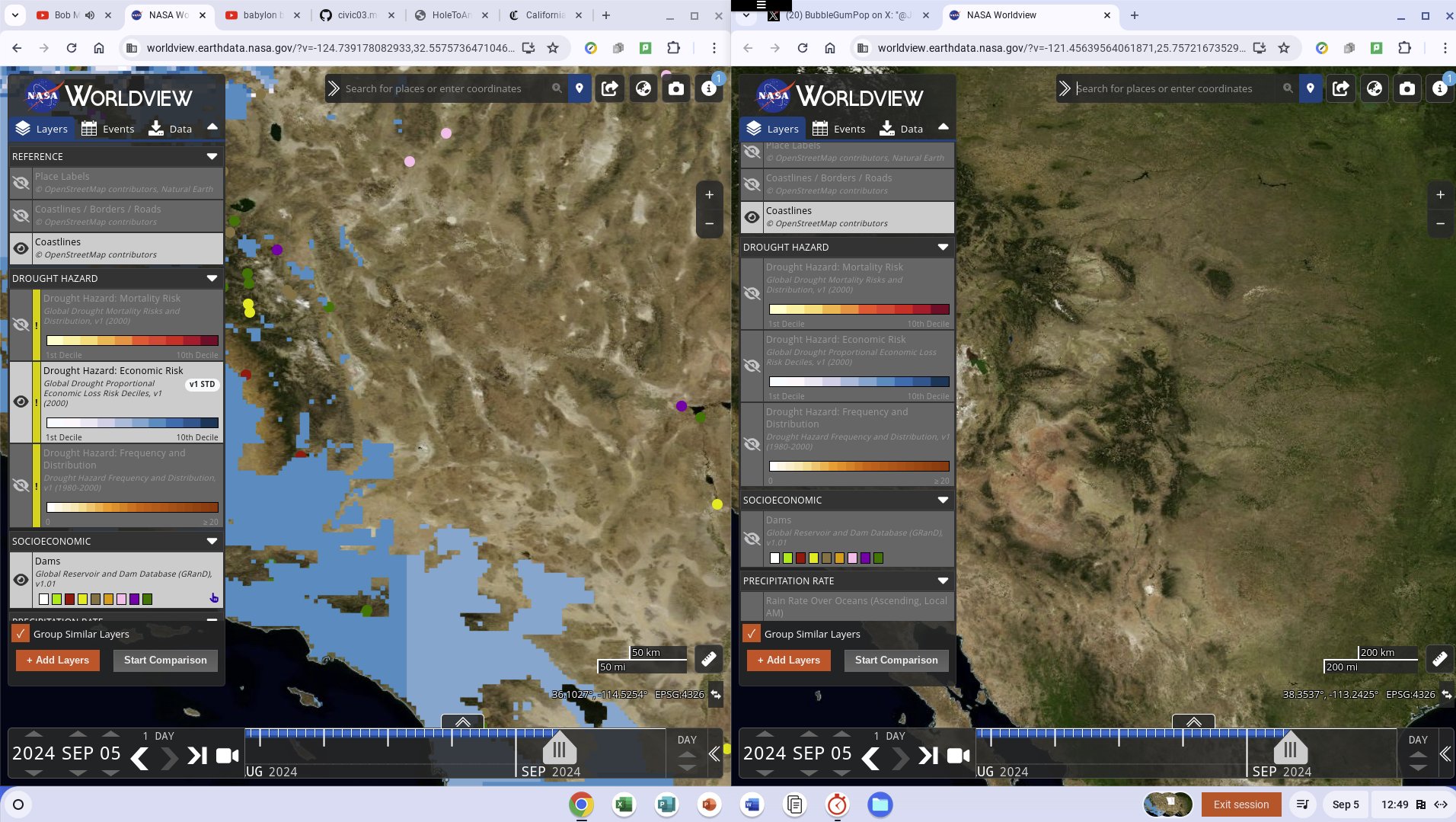
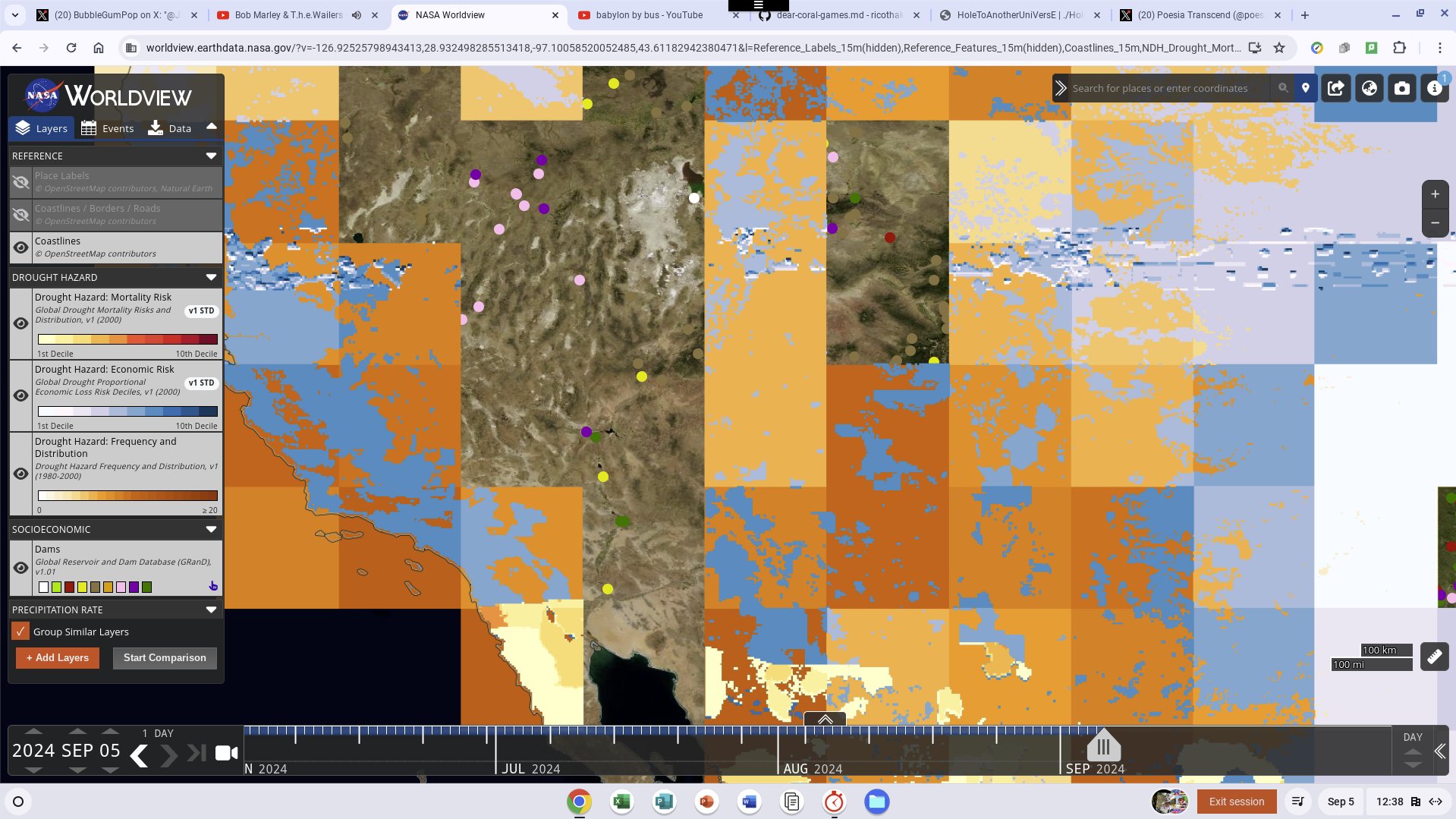
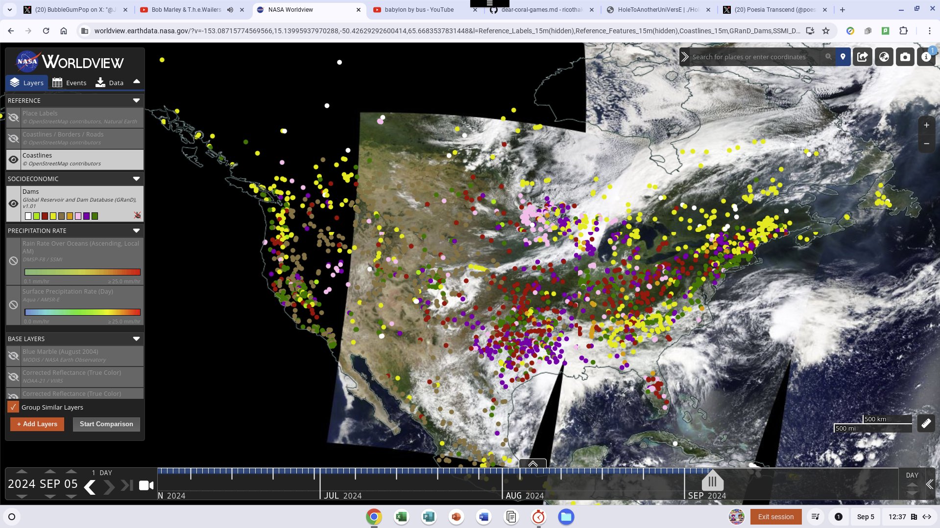
We acknowledge the use of imagery from the NASA Worldview application (https://worldview.earthdata.nasa.gov), part of the NASA Earth Science Data and Information System (ESDIS).
Hall of Justice (Los Angeles)
I discovered a building https://mva.lacounty.gov/bhph/ https://hmdb.org/m.asp?m=167926 “Bob Hope PAtriotic HAll” the #Architecure is amazing I know I’m not sworn in but I’m #ActiveMission and im noticing a CyberAttack in losangeles. https://www.laconservancy.org/ has records of buildings that have really shallow websites. Its kinda like USPTO old perl sections. Its like a whole section of internet history wass disabled for CoronaVirus (COVID-19/SARS-CoV-2 Data in PubChem)
Wiki
The Hall of Justice in Los Angeles is located at 211 W. Temple Street in the Civic Center district of Downtown Los Angeles. It occupies the southern two-thirds of the block between Temple and First streets and between Broadway and Spring streets.
Built in 1925, it was together with Los Angeles City Hall the first two large buildings opened in what would over the following decades demolish and transform the late-19th-century Central Business District to a Civic Center of modern landmark buildings and plazas. @LACMVA


## CityHall
Los Angeles City Hall, 200 North Spring Street, Los Angeles, Los Angeles County, CA
Courtyard arcade - Los Angeles City Hall, 200 North Spring Street, Los Angeles, Los Angeles County, CA


 Interior, Council Chamber - Los Angeles City Hall, 200 North Spring Street, Los Angeles, Los Angeles County, CA
John Ash, AIA, Photographer August 1997. VIEW OF LOS ANGELES CITY HALL TENTH FLOOR NORTH OFFICE WING,
FACING SOUTH - Los Angeles City Hall, 200 North Spring Street, Los Angeles, Los Angeles County, CA


Los Angeles Aqueduct, Antelope Valley, Los Angeles, Los Angeles County, CA
 View south/southeast looking down on 2nd Aqueduct and 1st Aqueduct Cascades towards filtration plant and Los Angeles Reservoir - Los Angeles Aqueduct, Cascades Structures, Los Angeles, Los Angeles County, CA Photos from Survey HAER CA-298-AH
1942 Los Angeles, California. Shoppers Lee, Russell, 1903-1986, photographer

 Los Angeles Aqueduct, Alabama Gates, Los Angeles, Los Angeles County, CA
 View south of principal Owens River diversion gates. Natural channel of river bed would bring flow of river through gates beneath walk rails in middle of picture. River is diverted to right for water supply purposes. - Los Angeles Aqueduct, Aqueduct Intake, Los Angeles, Los Angeles County, CA Photos from Survey HAER CA-298-Q 7 picture essay
 Los Angeles, California, aerial view 1967

 [Los Angeles Public Library at Los Angeles City Hall] digital file from original print

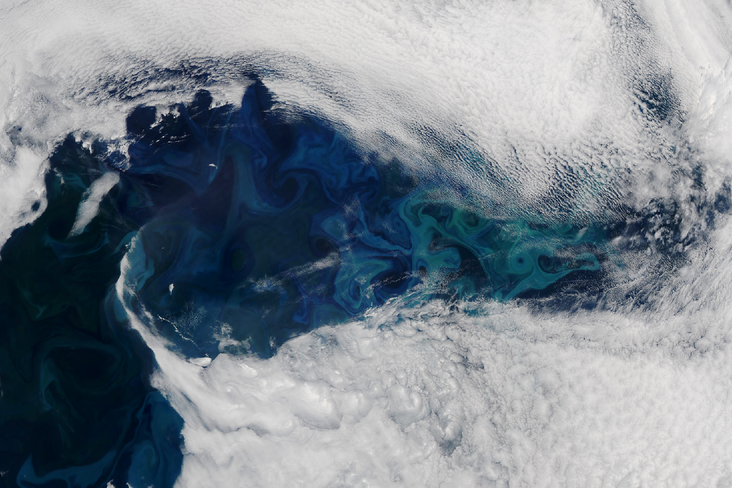
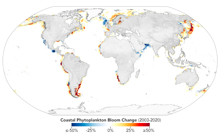
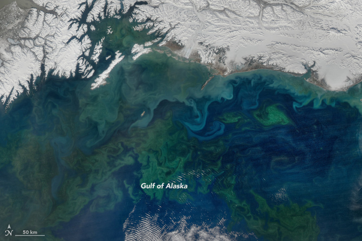
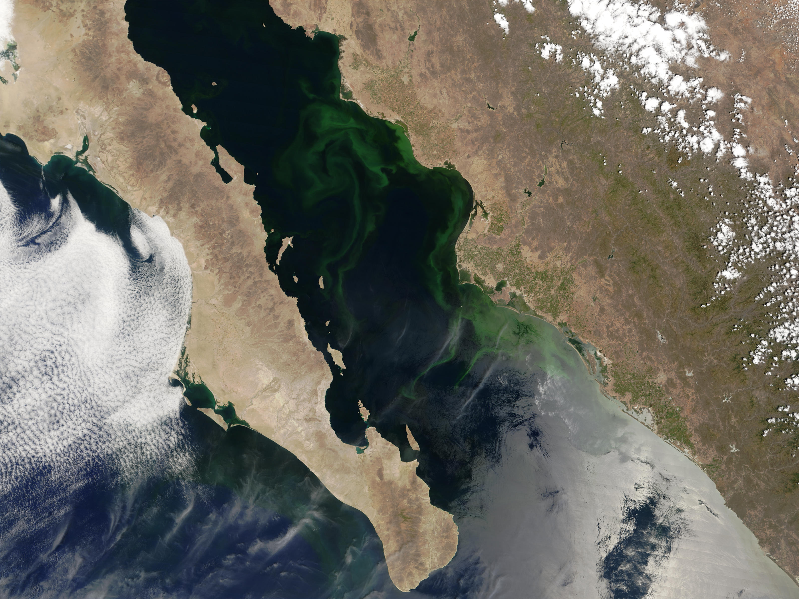
Coastal Phytoplankton on the Rise
An Ocean in Bloom 8/16/2024
PACE is NASA’s Plankton, Aerosol, Cloud, ocean Ecosystem mission,
 Get to Know PACE
 Phytoplankton Toxins and Their Potential Therapeutic Applications: A Journey toward the Quest for Potent Pharmaceuticals PDF
This data visualization shows 50 years of algal blooms collected across a spinning globe. Once all the data is accumulated, the globe then unwraps into a Robinson projection so the viewer can see the entire global dataset. WorldView
Peek-a-Bloom in the North Atlantic
NASA Wants to Identify Phytoplankton Species from Space. Here’s Why.
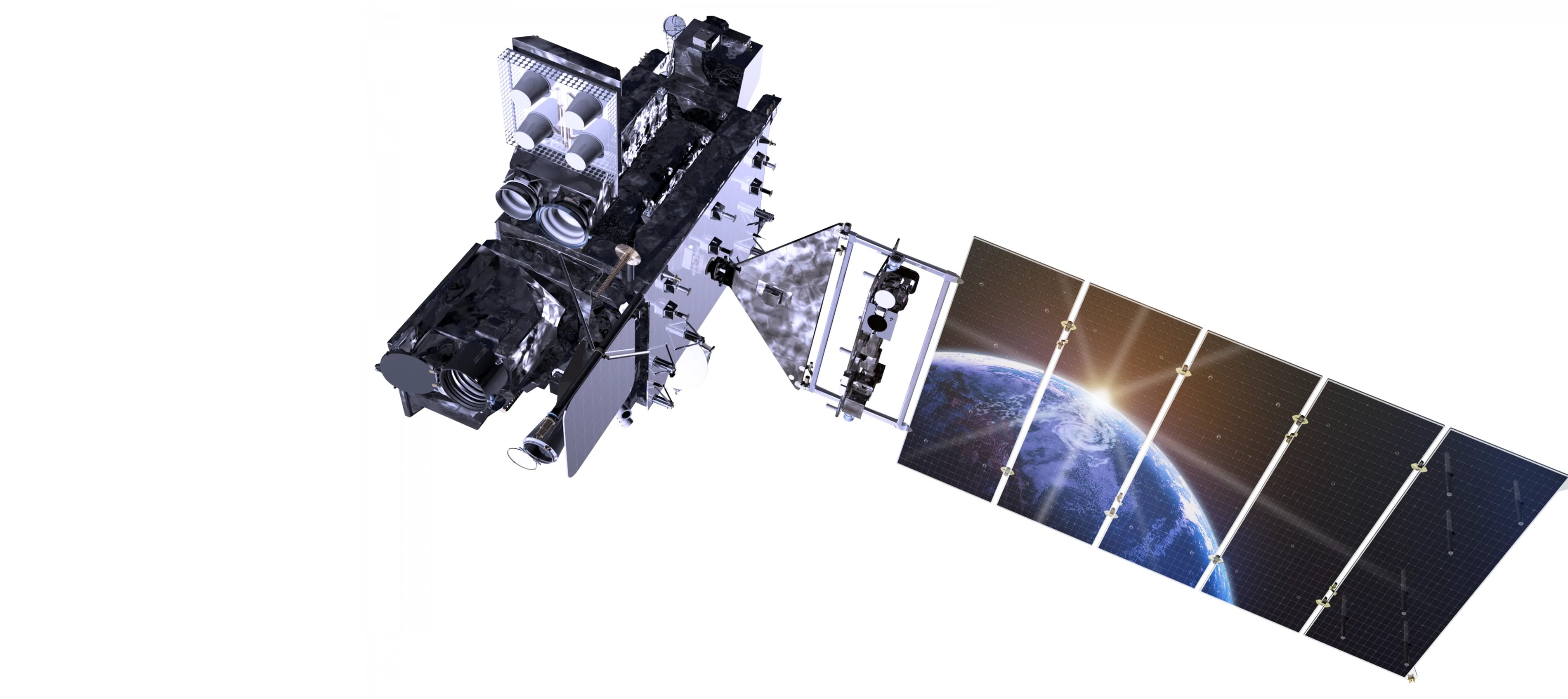
They’re small, but they’re mighty. From producing oxygen we breathe to soaking up carbon we emit to feeding fish we eat, tiny phytoplankton are a crucial part of ocean ecosystems and essential to life as we know it on Earth. To give us a new view of these extraordinary aquatic organisms, NASA is launching a satellite in early 2024.
Instruments on the PACE (short for Plankton, Aerosol, Cloud, and ocean Ecosystem) satellite will peer down at the ocean and collect data on the colors of light reflecting off it, telling us where different types of phytoplankton are thriving. Ivona Cetinić, the Science Lead for Ocean Biogeochemistry for PACE (Plankton, Aerosol, Cloud, ocean Ecosystem) describes the weird, wonderful and important world of phytoplankton and why it’s important for the PACE mission to study these tiny creatures. The Insanely Important World of Phytoplankton


MODiS
 MODIS (or Moderate Resolution Imaging Spectroradiometer) is a key instrument aboard the Terra (originally known as EOS AM-1) and Aqua (originally known as EOS PM-1) satellites. Terra’s orbit around the Earth is timed so that it passes from north to south across the equator in the morning, while Aqua passes south to north over the equator in the afternoon. MODIS Land Science Team
Badge of Shame - Breaking into Secure Facilities with OSDP - Dan Petro and David Vargas.mp4
Badge of Shame - Breaking into Secure Facilities with OSDP - Dan Petro and David Vargas.mp4


AIRSAR Operations Overview
Functionally, a typical AIRSAR operations can be divided into four main parts: (1) mission planning, (2) instrument maintenance and upgrades, (3) mission and flight operations, and (4) data processing and distribution. In reality, mission planning for the next year (and to some extent flight operations for the next year) takes place at the same time as data processing and distribution for the previous flight season. In this chapter a general discussion of AIRSAR operations is given.
2-1 Flight Request/Approval
AIRSAR flights are performed in response to flight requests submitted by the Principal Investigators (PIs) of NASA-sponsored scientific investigations and by sponsors from other organizations who contract to acquire AIRSAR data on a reimbursable basis. Appendix X contains a blank flight request, copies of which are available from the Aircraft Programs office at Ames Research Center in Mountain View, CA. A completed sample flight request is shown in Figure 2.X. Upon completion, flight requests should be sent to Ames Research Center and the relevant Program Manager at NASA Headquarters. Each year, usually in June, the cognizant NASA Headquarters Program Office reviews flight requests. Once NASA approves flight requests, Ames Research Center creates a mission schedule. Flight requests are typically due at Ames Research Center at the end of June each year, but a longer lead time may be necessary when a mission involves basing the DC-8 away from Moffett Field for extended periods.
2-4 Flight Operations
One of the most important phases of an AIRSAR campaign is the day to day flight operations when the AIRSAR data are acquired. For any given day a strawman flight plan is defined by the AIRSAR Experiment Scientist and passed on to the Ames navigators about two days before the actual flight is scheduled to take place. This lead time allows the navigators to generate an official flight plan and to file it with the relevant authorities for approval. In some cases, such as on deployments away from Moffett Field (and especially on deployments in foreign countries) flight plans must be filed well in advance of the actual flight date and last minute changes are not possible.


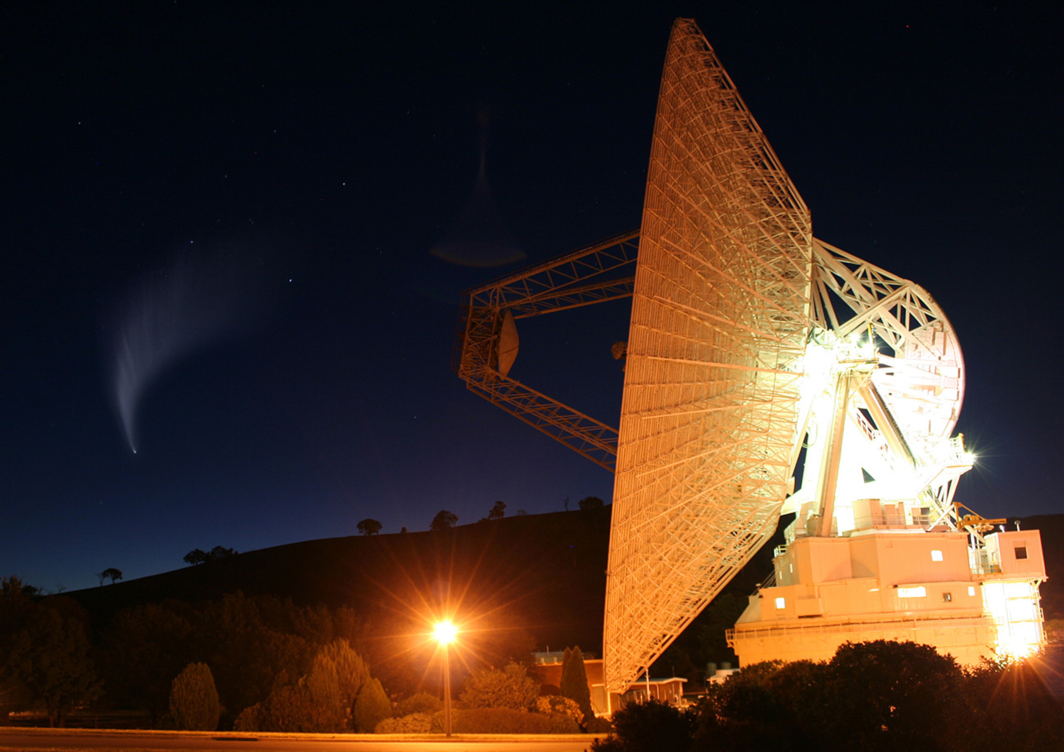
What is the Deep space Network?
The Deep Space Network – or DSN – is NASA’s international array of giant radio antennas that supports interplanetary spacecraft missions, plus a few that orbit Earth. The DSN also provides radar and radio astronomy observations that improve our understanding of the solar system and the larger universe.
The DSN is operated by NASA’s Jet Propulsion Laboratory (JPL), which also operates many of the agency’s interplanetary robotic space missions. The DSN consists of three facilities spaced equidistant from each other – approximately 120 degrees apart in longitude – around the world. These sites are at Goldstone, near Barstow, California; near Madrid, Spain; and near Canberra, Australia. The strategic placement of these sites permits constant communication with spacecraft as our planet rotates – before a distant spacecraft sinks below the horizon at one DSN site, another site can pick up the signal and carry on communicating.


JunoCam
JUNO as featured in the Planetary Data System
https://photojournal.jpl.nasa.gov/mission/Juno
Climate tool 4L8tR
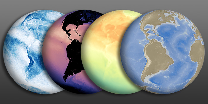 Welcome to NASA Earth Observations (NEO)
One of the best places to study Earth is from space. NASA satellites continually orbit the globe, collecting information about Earth’s ocean, atmosphere, and land surfaces. Satellites can even monitor the activity of life forms, such as phytoplankton, from their remote vantage points. Satellite imagery provides the greatest benefit to the most people when it can be analyzed by anyone with an interest. NEO strives to make global satellite imagery as accessible as possible.
What is CERES?
Climate is controlled by the amount of sunlight absorbed by Earth and the amount of infrared energy emitted to space. These quantities–together with their difference–define Earth’s radiation budget (ERB). Get_Environment_Data

GOES Satellite Network
 Geostationary Operational Environmental Satellites (GOES) is a collaborative NOAA and NASA program providing continuous imagery and data on atmospheric conditions and solar activity ( space weather ). NASA builds and launches the GOES and NOAA operates them.Geostationary Operational Environmental Satellites (GOES) is a collaborative NOAA and NASA program providing continuous imagery and data on atmospheric conditions and solar activity ( space weather ). NASA builds and launches the GOES and NOAA operates them. GOES Image Viewer GOES-East - Sector view: Southeast

![]()
ViSiBLEEARTH https://visibleearth.nasa.gov/
![]()

The ASTER Project consists of two parts, each having a Japanese and a U.S. component. Mission operations are split between Japan Space Systems (J-spacesystems) and the Jet Propulsion Laboratory (JPL) in the U.S. J-spacesystems oversees monitoring instrument performance and health, developing the daily schedule command sequence, processing Level 0 data to Level 1, and providing higher level data processing, archiving, and distribution. The JPL ASTER project provides scheduling support for U.S. investigators, calibration and validation of the instrument and data products, coordinating the U.S. Science Team, and maintaining the science algorithms. The joint Japan/U.S. ASTER Science Team has about 40 scientists and researchers. The “Team” link at the left leads to an organizational chart for the U.S. effort. Information about Japan Science Team members may be found on the Japanese ASTER Science Project web page at J-spacesystems.

![]()


NASA’s Earth Science Data Systems (ESDS) Program oversees the life cycle of NASA’s Earth science data—from acquisition through processing and distribution. The primary goal of ESDS is to maximize the scientific return from NASA’s missions and experiments for research and applied scientists, decision makers, and society at large.
LandsatLook


FiRMS Fire Information for Resource Management System US / Canada
FIRMS US/Canada is a joint effort by NASA and the USDA FOREST SERVICE to provide access to low latency satellite imagery and science data products from EARTH OBSERVATION SYSTEM (EOS) satellite assets to identify the location, extent and intensity of wildfire activity and its effects.
Map Main Page


 NASA SPoRT
Short-term Prediction Research and Transition Center
Marshall Space Flight Center, Huntsville, AL
NASA SPoRT
Short-term Prediction Research and Transition Center
Marshall Space Flight Center, Huntsville, AL


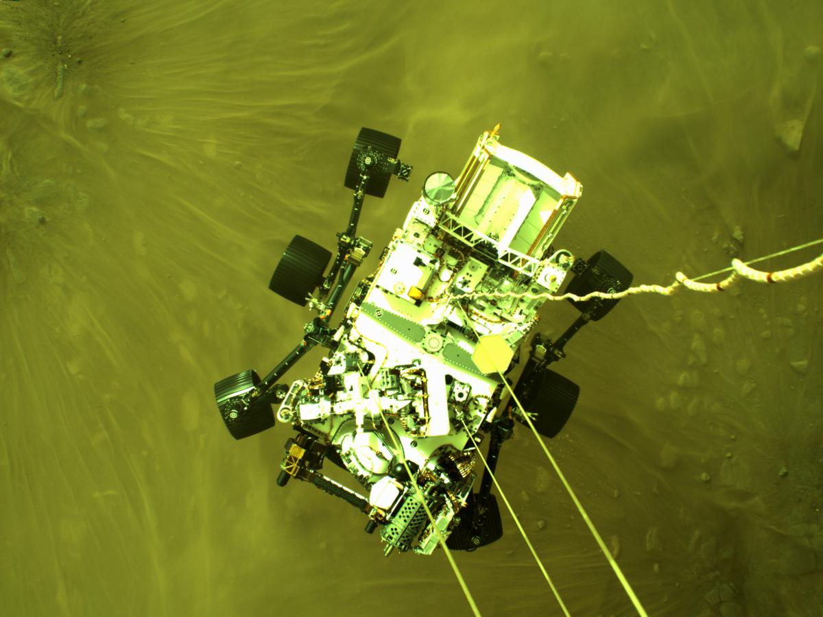
Mars Perseverance Sol 0: Descent Stage Down-Look Camera
object-fit The object-fit CSS property sets how the content of a replaced element, such as an ![]() or
or
Design for different form factors
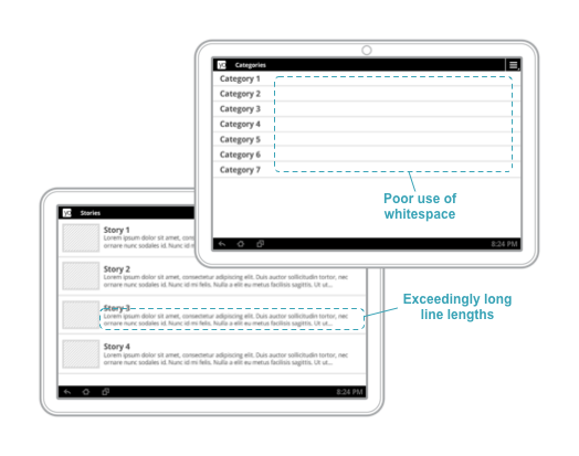 The design of your app’s UI isn’t tied to a particular device form factor. Android applications need to adapt to a number of different types of devices, from 4-inch handsets to 50-inch TVs to ChromeOS devices with resizable windows. readmore - developer.android.com
FLexBox - flex-direction , Im working on the main container for HoletoAnotherUniverse - /ricothaka thats the old compared to the new
TELNET COMMANDS - ulTRAX’S ARCHIVE
TELNET - LIST OF TELNET SERVERS - Places to Telnet
Places to Telnet - TELNET.ORG
TELNETDiR - https://victoria.tc.ca/history/internet/telnet-sites.html - BLOCKED at LAPL
What are your favorite Telnet sites (Besides Fozz’s) - REDDiT r/retrobattlestations/
gfortran — the GNU Fortran compiler, part of GCC Gfortran is the name of the GNU Fortran project, developing a free Fortran 95/2003/2008/2018 compiler for GCC
!
! Welcome to GDB Online.
! GDB online is an online compiler and debugger tool for C, C++, Python, Java, PHP, Ruby, Perl,
! C#, OCaml, VB, Swift, Pascal, Fortran, Haskell, Objective-C, Assembly, HTML, CSS, JS, SQLite, Prolog.
! Code, Compile, Run and Debug online from anywhere in world.
!
!

Program Hello
!Print *, "Hello World

!End Program Hello

!program hello
  ! This is a comment line; it is ignored by the compiler
  print *, 'Hello, World!'
end program Hello
# [Heading Link](#section-i-want)
### [1. Anchor Link](#anchor-link)
# 1.1 [Header](#1.1)
{#id .myClass width=40 height=50}
Fire Information for Resource Management System FiRMS
NASA | LANCE | FIRMS - NASA Firms


Image scaling
In computer graphics and digital imaging, image scaling refers to the resizing of a digital image. In video technology, the magnification of digital material is known as upscaling or resolution enhancement.
When scaling a vector graphic image, the graphic primitives that make up the image can be scaled using geometric transformations with no loss of image quality.
Scalable Vector Graphics (SVG) is an XML-based vector image format for defining two-dimensional graphics, having support for interactivity and animation. The SVG specification is an open standard developed by the World Wide Web Consortium since 1999. SVG
By Original: Kieff and Mysid Vector: OmegaFallon - Own work; vectorization of: 2xsai example.png, CC BY-SA 3.0, Link https://red-route.org/code/image-resizing-calculator
Speed up your Jekyll builds - Mike Neumegen Use front matter to add metadata to your content. GoHUGO - FRONTMATTER Docs SVG DROPSHADOWS - CSSTRiCKS Upgrading to Jekyll 4 and overhauling Theme All versions of jekyll - rubygems.org Organising my Jekyll Blog with Categories CatagoryLoop 3 Simple steps to setup Jekyll Categories and Tags JeKYLL DATE+TiME
https://ricothaka.github.ioHow to resize an image in HTML? It’s time to lazy-load offscreen iframes!
URL Pairing
Psuedo Selectors
https://developer.mozilla.org/en-US/docs/Web/CSS/::before + https://codepen.io/thakarashard/pen/mdYZrrV #TechnologyEducation #StemEducation pairing
Saturday Family Night Fantasy with Pizza
https://www.retrogames.cc/arcade-games/red-earth-war-zard-euro-961121.html+https://archive.org/details/a137ee3e2a37701695abd791d95bfeaf-1080p
Building a Smarter Los Angeles: Data, Blockchain, and the Smart City By Ted Ross (MoCo Los Angeles) Smart LA SMartCities PDF
Normani I dont know whats going on in your world. But I got my worknotes sored here. BlockQuote is heavily filtered at the library so I dont know what it really looks like
img[alt="whiteslavery"] { max-width: 20%;}
img[alt="whiteslavery40"] { max-width: 40%; transform: rotate(45deg);}
markdown

HTML5
img[alt=”whiteslavery”] { max-width: 20%;}
img[alt=”whiteslavery40”] { max-width: 40%; transform: rotate(45deg);}
Passing parameters to includes
You can also pass parameters to an include. For example, suppose you have a file called note.html in your _includes folder that contains this formatting:
<div markdown="span" class="alert alert-info" role="alert">
<i class="fa fa-info-circle"></i> <b>Note:</b>
{{ include.content }}
</div>
ALiSTAPART_The Bathing Ape Has No Clothes (and other notes on the distinction between style and design) ALiSTAPART_Design Choices Can Cripple a Website ALiSTAPART_Good Designers Redesign, Great Designers Realign ALiSTAPART_Designing Through the Storm ALiSTAPART_Staying Motivated ALiSTAPART_Understanding Web Design ALiSTAPART_Marry Your Clients ALiSTAPART_Personality in Design ALiSTAPART_Before You Hire Designers ALiSTAPART_Planning for Accessibility ALiSTAPART_Trans-inclusive Design ALiSTAPART_Immersive Content Strategy ALiSTAPART_Designing Inclusive Content Models NYPLBase The Library’s rapid prototyping system and design pattern library NYPL_STYLEGUiDE_ARCHiVE
Mars is the fourth planet from the Sun, and the seventh largest. It’s the only planet we know of inhabited entirely by robots.

Normani please look at this old post, it is a marker for how long i have been focused on Programming CSS
SUNDAY, NOVEMBER 21TH, 2021
Im working on CSS
Since I’m publishing using ##GiTHUB_PAGES, alot of administration needs are met from my GiTHUB_ACCOUNT, I can focus on coding. Cascading Style Sheets is a legit programming language for the browser. Using the site David Shea Started, I can get this Jekyll account to another level. I really need this book The Zen of CSS he published. I have to create navigation to my resume and create a contact page. Im using GiTHUB Repositories to manage individual pages right now because it is a small site and I want psychological separation which social media does not provide. I was blackballed on Linkedin for just not knowing enough for my age, and my family+romance life. Every woman that committed to me was sold into sex slavery and kidnapped by ##INSTAGRAM_PiMPS_and_MARKETED_iN_FACEBOOK_BROTHELS. They are still trafficked as prostitutes. IT people in the DEVOPS generation often fool themselves into thinking prostitution is normal and the family which is affected is the problem. This view has left people with familes discriminated against in the ##IT_MARKETPLACE, but here in Los Angeles after 2 years of homelessness, I sense my luck changing… So Im working hard to clean up my image and reputation outside social media, which has brought me closer to my family
I_FOUND_EVERYONE ALiVE_HERE_IN_SOUTHERn CALIFORNIA
. I cant test touch screens at this point from Palmdale Public Library’s traditional Optiplex desktops Memphis police release photos of 2 suspects wanted over Young Dolph’s shooting death
Another bill again-Tony Rebel McDonalds Ronald McDonald and Mayor McCheese in Space, 1978 Another bill again-Tony Rebel Astronaut Chick Truth Gonna Hurt You <~ late for work ? idk
Tesla Coils at Griffith Observatory video
Tesla coil is an electrical resonant transformer circuit designed by inventor Nikola Tesla in 1891.[1] It is used to produce high-voltage, low-current, high-frequency alternating-current electricity.[2][3] Tesla experimented with a number of different configurations consisting of two, or sometimes three, coupled resonant electric circuits.
FlexBox Demo


RegEx
webrename <~ Bulk file renamer takes regex. I got stuck on ricothaka.github.io/worknotes02 bc the scanner at LaPL central spits out horrible filenames. I found great images from Mariner for Robins Weather Chores. Its old but as time rolls on im understanding the fact that historical weather data can help you uinderstand the present
